 vesseltracker.com
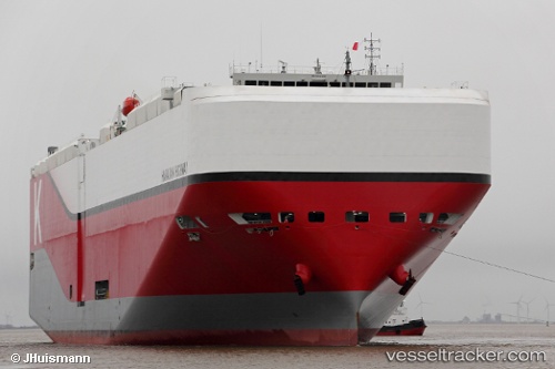
Hawaiian Highway
Current StatusWhere is the vessel?
Hawaiian Highway is currently in 33 nm NE of Corcos, based on AIS data received about 2h ago.
Latest AIS update:
Current position: 42.17333° N, 43.61500° W (33 nm NE of Corcos)
Average speed (last 7 days): Loading…
Average speed (last 30 days): Loading…
Vessel profile: Hawaiian Highway is a Vehicles Carrier with dimensions 40m x 199m.
This page combines live AIS, route history, probable destination signals, nearby traffic, and port activity for practical vessel monitoring.
The current position of vessel Hawaiian Highway is 42.17333 lat / -43.61500 lng. Updated: 2026-03-26 05:52:42 UTCDetails:
Live Vessel Hawaiian Highway Analytics (details, animations, etc.)
Recent AIS points (UTC):
2026-03-25 23:52:42 UTC · 41.64167, -45.66500 · SOG 13 kn · COG -1°2026-03-26 01:40:53 UTC · 41.79115, -45.11590 · SOG 14.9 kn · COG 70°
2026-03-26 03:53:44 UTC · 41.99017, -44.33658 · SOG 17.4 kn · COG 78°
2026-03-26 05:52:42 UTC · 42.17333, -43.61500 · SOG 17 kn · COG -1°