 vesseltracker.com
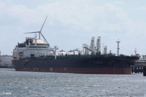
 TORM HANNAH
Current Status
Where is the vessel?
TORM HANNAH is currently in Open sea (no nearby ports in database), based on AIS data received less than 1h ago.
Latest AIS update:
Current position: 25.40792° S, 2.48601° W (Open sea (no nearby ports in database))
Average speed (last 7 days): Loading…
Average speed (last 30 days): Loading…
Vessel profile: TORM HANNAH is a Crude Oil Tanker with dimensions 249m x 44m.
This page combines live AIS, route history, probable destination signals, nearby traffic, and port activity for practical vessel monitoring.
The current position of vessel TORM HANNAH is -25.40792 lat / -2.48601 lng. Updated: 2026-03-29 09:53:41 UTCNearest reference points:
- Open sea (no nearby ports in database)
Currently sailing under the flag of Denmark (DIS) ![]()
TORM HANNAH built in 2016 year
Deadweight:
109999 tDetails:
Live Vessel TORM HANNAH Analytics (details, animations, etc.)
Recent AIS points (UTC):
2026-03-29 03:23:38 UTC · -24.68994, -3.67062 · SOG 12.9 kn · COG 126°2026-03-29 05:53:28 UTC · -24.99365, -3.19045 · SOG 12.9 kn · COG 124°
2026-03-29 08:24:17 UTC · -25.28919, -2.68970 · SOG 13.1 kn · COG 124°
2026-03-29 09:53:41 UTC · -25.40792, -2.48601 · SOG 2.2 kn · COG 162°