 vesseltracker.com
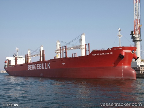
 Berge Hakodate
Current Status
Where is the vessel?
Berge Hakodate is currently in 14 nm S of Cape Leeuwin, based on AIS data received about 1h ago.
Latest AIS update:
Current position: 34.75834° S, 115.15525° E (14 nm S of Cape Leeuwin)
Average speed (last 7 days): Loading…
Average speed (last 30 days): Loading…
Vessel profile: Berge Hakodate is a Bulk Carrier with dimensions 180m x 30m.
This page combines live AIS, route history, probable destination signals, nearby traffic, and port activity for practical vessel monitoring.
The current position of vessel Berge Hakodate is -34.75834 lat / 115.15525 lng. Updated: 2026-04-06 05:40:53 UTCNearest reference points:
- Near Bunbury
Currently sailing under the flag of United Kingdom ![]()
Details:
Live Vessel Berge Hakodate Analytics (details, animations, etc.)
Recent AIS points (UTC):
2026-04-05 23:47:50 UTC · -33.72134, 114.33006 · SOG 13.5 kn · COG 139°2026-04-06 01:37:14 UTC · -34.04771, 114.59373 · SOG 12.6 kn · COG 167°
2026-04-06 03:30:55 UTC · -34.43910, 114.72677 · SOG 13 kn · COG 165°
2026-04-06 05:40:53 UTC · -34.75834, 115.15525 · SOG 13.4 kn · COG 128°