 vesseltracker.com
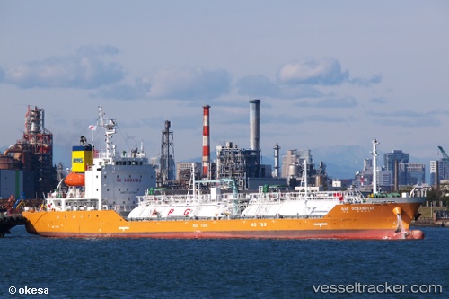
 Gas Oceanroad
Current Status
Where is the vessel?
Gas Oceanroad is currently in 39 nm SE of Toboali, based on AIS data received less than 1h ago.
Latest AIS update:
Current position: 3.56667° S, 106.82333° E (39 nm SE of Toboali)
Average speed (last 7 days): Loading…
Average speed (last 30 days): Loading…
Vessel profile: Gas Oceanroad is a Lpg Tanker with dimensions 96m x 15m.
This page combines live AIS, route history, probable destination signals, nearby traffic, and port activity for practical vessel monitoring.
The current position of vessel Gas Oceanroad is -3.56667 lat / 106.82333 lng. Updated: 2026-04-17 17:57:23 UTCNearest reference points:
- 46 nm NW of Tanjung Pandan
- Near PANGKAL BALAM
- 96 nm E of Widuri
Currently sailing under the flag of Korea ![]()
Details:
Live Vessel Gas Oceanroad Analytics (details, animations, etc.)
Recent AIS points (UTC):
2026-04-17 11:57:21 UTC · -2.43833, 106.82667 · SOG 11 kn · COG -1°2026-04-17 13:36:22 UTC · -2.73833, 106.92667 · SOG 11 kn · COG -1°
2026-04-17 15:45:23 UTC · -3.15167, 106.94833 · SOG 11 kn · COG -1°
2026-04-17 17:57:23 UTC · -3.56667, 106.82333 · SOG 11 kn · COG -1°