 vesseltracker.com
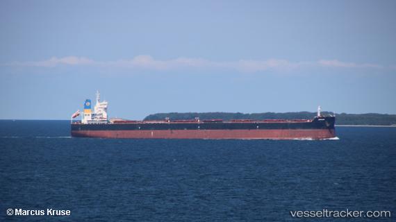
 Ronadi
Current Status
Where is the vessel?
Ronadi is currently in 33 nm NE of Luoniushan, based on AIS data received about 1h ago.
Latest AIS update:
Current position: 20.25198° N, 111.00161° E (33 nm NE of Luoniushan)
Average speed (last 7 days): Loading…
Average speed (last 30 days): Loading…
Vessel profile: Ronadi is a Bulk Carrier with dimensions 229m x 32m.
This page combines live AIS, route history, probable destination signals, nearby traffic, and port activity for practical vessel monitoring.
The current position of vessel Ronadi is 20.25198 lat / 111.00161 lng. Updated: 2026-04-19 12:03:20 UTCNearest reference points:
- 22 nm E of Dongjiaotou Pt
- Near Dongjiaotou Pt
- 57 nm NE of Honghai
Currently sailing under the flag of Liberia ![]()
Details:
Live Vessel Ronadi Analytics (details, animations, etc.)
Recent AIS points (UTC):
2026-04-19 08:22:31 UTC · 20.18133, 110.35498 · SOG 9.4 kn · COG 77°2026-04-19 10:07:54 UTC · 20.23346, 110.64815 · SOG 9.2 kn · COG 91°
2026-04-19 10:17:51 UTC · 20.23487, 110.67538 · SOG 9.8 kn · COG 93°
2026-04-19 12:03:20 UTC · 20.25198, 111.00161 · SOG 11.3 kn · COG 70°