 vesseltracker.com
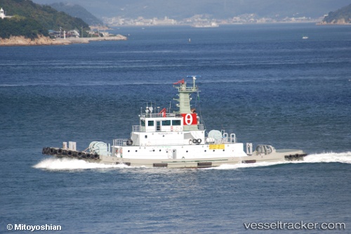
Hojinmaru
Current StatusWhere is the vessel?
Hojinmaru is currently in Near AJICHO, based on AIS data received about 1d ago.
Latest AIS update:
Current position: 34.42598° N, 134.17216° E (Near AJICHO)
Average speed (last 7 days): Loading…
Average speed (last 30 days): Loading…
Vessel profile: Hojinmaru is a Tug with dimensions 9m x 39m.
This page combines live AIS, route history, probable destination signals, nearby traffic, and port activity for practical vessel monitoring.
The current position of vessel Hojinmaru is 34.42598 lat / 134.17216 lng. Updated: 2026-04-10 08:22:22 UTCNearest reference points:
- Near AJICHO
- Near TONOSHO
- Near TAKAMATSU
Details:
Live Vessel Hojinmaru Analytics (details, animations, etc.)
Recent AIS points (UTC):
2026-04-09 13:03:48 UTC · 34.47318, 133.75787 · SOG 2.1 kn · COG 76°2026-04-09 13:03:48 UTC · 34.47318, 133.75787 · SOG 2.1 kn · COG 76°
2026-04-10 05:45:16 UTC · 34.49458, 133.73335 · SOG 2.5 kn · COG 342°
2026-04-10 08:22:22 UTC · 34.42598, 134.17216 · SOG 11.9 kn · COG 296°