 vesseltracker.com
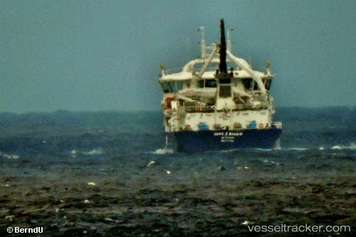
 Hans A Bakka
Current Status
Where is the vessel?
Hans A Bakka is currently in Near Klaksvig, based on AIS data received about 1h ago.
Latest AIS update:
Current position: 62.30145° N, 6.60384° W (Near Klaksvig)
Average speed (last 7 days): Loading…
Average speed (last 30 days): Loading…
Vessel profile: Hans A Bakka is a Live Fish Carrier with dimensions 75m x 75m.
This page combines live AIS, route history, probable destination signals, nearby traffic, and port activity for practical vessel monitoring.
The current position of vessel Hans A Bakka is 62.30145 lat / -6.60384 lng. Updated: 2026-04-19 19:39:01 UTCNearest reference points:
- Near FUGLAFJORDUR
- Near VESTMANNA
- 20 nm S of Vágur
Currently sailing under the flag of Faroe Is ![]()
Details:
Live Vessel Hans A Bakka Analytics (details, animations, etc.)
Recent AIS points (UTC):
2026-04-19 16:18:36 UTC · 62.29904, -6.60843 · SOG 0.7 kn · COG 174°2026-04-19 18:00:47 UTC · 62.30384, -6.59682 · SOG 0 kn · COG 171°
2026-04-19 19:11:00 UTC · 62.30006, -6.60380 · SOG 0 kn · COG 155°
2026-04-19 19:39:01 UTC · 62.30145, -6.60384 · SOG 0.2 kn · COG 156°