 vesseltracker.com
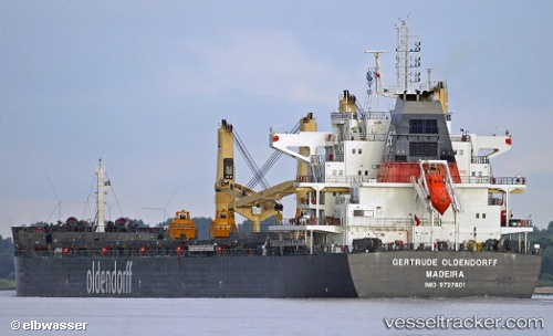
 Gertrude Oldendorff
Current Status
Where is the vessel?
Gertrude Oldendorff is currently in 14 nm S of Abu Musa, based on AIS data received less than 1h ago.
Latest AIS update:
Current position: 25.64116° N, 54.99202° E (14 nm S of Abu Musa)
Average speed (last 7 days): Loading…
Average speed (last 30 days): Loading…
Vessel profile: Gertrude Oldendorff is a Bulk Carrier with dimensions 230m x 32m.
This page combines live AIS, route history, probable destination signals, nearby traffic, and port activity for practical vessel monitoring.
The current position of vessel Gertrude Oldendorff is 25.64116 lat / 54.99202 lng. Updated: 2026-04-04 05:32:12 UTCNearest reference points:
- 17 nm NW of Free Port
- Near Free Port
- Near Sharjah
Currently sailing under the flag of Portugal ![]()
Details:
Live Vessel Gertrude Oldendorff Analytics (details, animations, etc.)
Recent AIS points (UTC):
2026-04-03 23:32:10 UTC · 25.63991, 54.98887 · SOG 0 kn · COG 114°2026-04-04 01:50:12 UTC · 25.64123, 54.99059 · SOG 0 kn · COG 175°
2026-04-04 03:38:12 UTC · 25.64109, 54.99184 · SOG 0.1 kn · COG 210°
2026-04-04 05:32:12 UTC · 25.64116, 54.99202 · SOG 0.1 kn · COG 217°