 vesseltracker.com
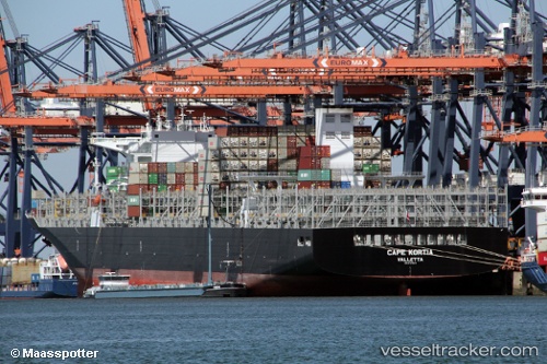
Cape Kortia
Current StatusWhere is the vessel?
Cape Kortia is currently in Near Balboa, based on AIS data received less than 1h ago.
Latest AIS update:
Current position: 8.96038° N, 79.57634° W (Near Balboa)
Average speed (last 7 days): Loading…
Average speed (last 30 days): Loading…
Vessel profile: Cape Kortia is a Container Ship with dimensions 48m x 330m.
This page combines live AIS, route history, probable destination signals, nearby traffic, and port activity for practical vessel monitoring.
The current position of vessel Cape Kortia is 8.96038 lat / -79.57634 lng. Updated: 2026-04-18 06:20:53 UTCNearest reference points:
- Near Cocoli
- Near El Chorrillo
- Near Panama
Details:
Live Vessel Cape Kortia Analytics (details, animations, etc.)
Recent AIS points (UTC):
2026-04-18 00:06:46 UTC · 8.96040, -79.57630 · SOG 0 kn · COG 333°2026-04-18 02:26:55 UTC · 8.96040, -79.57634 · SOG 0 kn · COG 333°
2026-04-18 03:53:55 UTC · 8.96037, -79.57633 · SOG 0.1 kn · COG 333°
2026-04-18 06:20:53 UTC · 8.96038, -79.57634 · SOG 0 kn · COG 333°