 vesseltracker.com
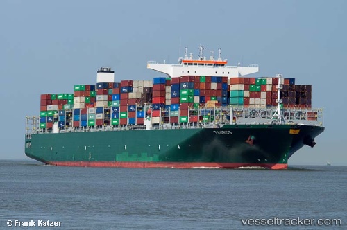
 Taurus
Current Status
Where is the vessel?
Taurus is currently in Near Yantian, based on AIS data received less than 1h ago.
Latest AIS update:
Current position: 22.57115° N, 114.26985° E (Near Yantian)
Average speed (last 7 days): Loading…
Average speed (last 30 days): Loading…
Vessel profile: Taurus is a Container Ship with dimensions 369m x 51m.
This page combines live AIS, route history, probable destination signals, nearby traffic, and port activity for practical vessel monitoring.
The current position of vessel Taurus is 22.57115 lat / 114.26985 lng. Updated: 2026-03-29 03:34:34 UTCNearest reference points:
- Near Yantian
- Near Shatoujiao
- Near Sai Kung
Currently sailing under the flag of Malta ![]()
Details:
Live Vessel Taurus Analytics (details, animations, etc.)
Recent AIS points (UTC):
2026-03-28 21:37:35 UTC · 22.57126, 114.26996 · SOG 0.1 kn · COG 320°2026-03-28 23:46:35 UTC · 22.57123, 114.26985 · SOG 0 kn · COG 320°
2026-03-29 00:34:36 UTC · 22.57123, 114.27002 · SOG 0 kn · COG 320°
2026-03-29 03:34:34 UTC · 22.57115, 114.26985 · SOG 0 kn · COG 320°