 vesseltracker.com
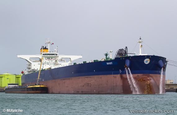
 OLYMPIC LUNA
Current Status
Where is the vessel?
OLYMPIC LUNA is currently in 154 nm SW of Veraval, based on AIS data received about 3d ago.
Latest AIS update:
Current position: 19.00371° N, 68.50939° E (154 nm SW of Veraval)
Average speed (last 7 days): Loading…
Average speed (last 30 days): Loading…
Vessel profile: OLYMPIC LUNA is a Crude Oil Tanker with dimensions 60m x 333m.
This page combines live AIS, route history, probable destination signals, nearby traffic, and port activity for practical vessel monitoring.
The current position of vessel OLYMPIC LUNA is 19.00371 lat / 68.50939 lng. Updated: 2026-04-13 20:57:10 UTCNearest reference points:
- 236 nm SW of Veraval
- 33 nm S of Mul Dwårka
Currently sailing under the flag of Marshall Islands ![]()
OLYMPIC LUNA built in 2017 year
Deadweight:
299337 tDetails:
Live Vessel OLYMPIC LUNA Analytics (details, animations, etc.)
Recent AIS points (UTC):
2026-04-13 19:56:05 UTC · 19.01708, 68.52070 · SOG 1 kn · COG 230°2026-04-13 20:57:10 UTC · 19.00371, 68.50939 · SOG 0.9 kn · COG 229°
2026-04-13 20:57:10 UTC · 19.00371, 68.50939 · SOG 0.9 kn · COG 229°
2026-04-13 20:57:10 UTC · 19.00371, 68.50939 · SOG 0.9 kn · COG 229°