 vesseltracker.com
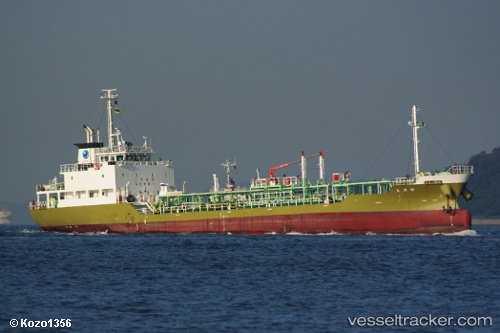
 Shinyo Maru
Current Status
Where is the vessel?
Shinyo Maru is currently in Near SAKAIMINATO, based on AIS data received about 2h ago.
Latest AIS update:
Current position: 35.53912° N, 133.30310° E (Near SAKAIMINATO)
Average speed (last 7 days): Loading…
Average speed (last 30 days): Loading…
Vessel profile: Shinyo Maru is a Chemical Oil Products Tanker with dimensions 72m x 11m.
This page combines live AIS, route history, probable destination signals, nearby traffic, and port activity for practical vessel monitoring.
The current position of vessel Shinyo Maru is 35.53912 lat / 133.30310 lng. Updated: 2026-04-10 08:21:31 UTCNearest reference points:
- Near FUKUYAMA
- Near Kurashiki
- Near MIZUSHIMA
Currently sailing under the flag of Japan ![]()
Details:
Live Vessel Shinyo Maru Analytics (details, animations, etc.)
Recent AIS points (UTC):
2026-04-10 01:52:31 UTC · 35.53998, 133.30190 · SOG 0.1 kn · COG 209°2026-04-10 03:55:22 UTC · 35.53948, 133.30234 · SOG 0.1 kn · COG 262°
2026-04-10 05:45:11 UTC · 35.53925, 133.30266 · SOG 0.1 kn · COG 259°
2026-04-10 08:21:31 UTC · 35.53912, 133.30310 · SOG 0.1 kn · COG 247°