 vesseltracker.com
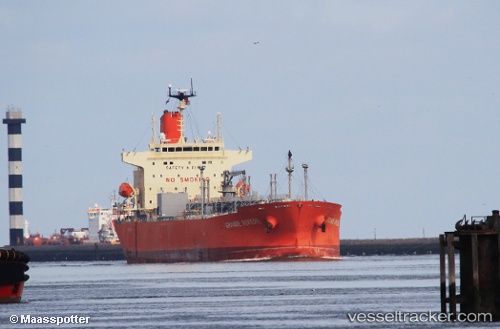
 GRANDE RIVIERE
Current Status
Where is the vessel?
GRANDE RIVIERE is currently in 80 nm E of Sam Lords Castle, based on AIS data received less than 1h ago.
Latest AIS update:
Current position: 13.35516° N, 58.09514° W (80 nm E of Sam Lords Castle)
Average speed (last 7 days): Loading…
Average speed (last 30 days): Loading…
Vessel profile: GRANDE RIVIERE is a Tanker with dimensions m x m.
This page combines live AIS, route history, probable destination signals, nearby traffic, and port activity for practical vessel monitoring.
The current position of vessel GRANDE RIVIERE is 13.35516 lat / -58.09514 lng. Updated: 2026-03-31 14:17:45 UTCNearest reference points:
- Near Saint Michael
Currently sailing under the flag of Panama ![]()
Details:
Live Vessel GRANDE RIVIERE Analytics (details, animations, etc.)
Recent AIS points (UTC):
2026-03-31 07:32:33 UTC · 12.66502, -59.30726 · SOG 12.5 kn · COG 64°2026-03-31 09:34:02 UTC · 12.88075, -58.93313 · SOG 12.1 kn · COG 58°
2026-03-31 11:30:36 UTC · 13.08499, -58.58685 · SOG 11.8 kn · COG 73°
2026-03-31 14:17:45 UTC · 13.35516, -58.09514 · SOG 11.9 kn · COG 64°