 vesseltracker.com
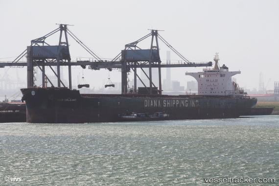
 New Orleans
Current Status
Where is the vessel?
New Orleans is currently in 64 nm S of Selat Lombok, based on AIS data received less than 1h ago.
Latest AIS update:
Current position: 9.88833° S, 115.87167° E (64 nm S of Selat Lombok)
Average speed (last 7 days): Loading…
Average speed (last 30 days): Loading…
Vessel profile: New Orleans is a Bulk Carrier with dimensions 292m x 45m.
This page combines live AIS, route history, probable destination signals, nearby traffic, and port activity for practical vessel monitoring.
The current position of vessel New Orleans is -9.88833 lat / 115.87167 lng. Updated: 2026-04-13 15:27:45 UTCNearest reference points:
- Near LEMBAR
- Near BENOA
- 86 nm SE of BENETE
Currently sailing under the flag of Marshall Is ![]()
Details:
Live Vessel New Orleans Analytics (details, animations, etc.)
Recent AIS points (UTC):
2026-04-13 09:57:04 UTC · -8.75578, 115.68657 · SOG 15.5 kn · COG 193°2026-04-13 11:51:06 UTC · -9.17157, 115.68861 · SOG 11.1 kn · COG 160°
2026-04-13 13:32:17 UTC · -9.49706, 115.76718 · SOG 13.3 kn · COG 165°
2026-04-13 15:27:45 UTC · -9.88833, 115.87167 · SOG 12 kn · COG -1°