 vesseltracker.com
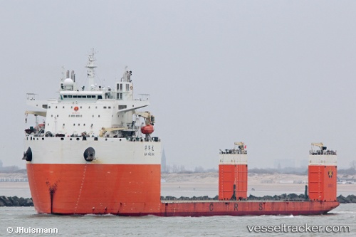
 Hua Yang Long
Current Status
Where is the vessel?
Hua Yang Long is currently in 134 nm NW of Eureka Springs, based on AIS data received about 1h ago.
Latest AIS update:
Current position: 37.97667° N, 41.71667° W (134 nm NW of Eureka Springs)
Average speed (last 7 days): Loading…
Average speed (last 30 days): Loading…
Vessel profile: Hua Yang Long is a Heavy Load Carrier with dimensions 228m x 43m.
This page combines live AIS, route history, probable destination signals, nearby traffic, and port activity for practical vessel monitoring.
The current position of vessel Hua Yang Long is 37.97667 lat / -41.71667 lng. Updated: 2026-04-18 03:24:24 UTCNearest reference points:
- 97 nm SE of Chapineria
- 47 nm W of Eureka Springs
Currently sailing under the flag of China ![]()
Details:
Live Vessel Hua Yang Long Analytics (details, animations, etc.)
Recent AIS points (UTC):
2026-04-17 22:11:51 UTC · 37.97146, -43.11702 · SOG 12.4 kn · COG 85°2026-04-18 00:12:02 UTC · 37.97316, -42.58710 · SOG 12.6 kn · COG 84°
2026-04-18 02:00:24 UTC · 37.97167, -42.09333 · SOG 13 kn · COG -1°
2026-04-18 03:24:24 UTC · 37.97667, -41.71667 · SOG 12 kn · COG -1°