 vesseltracker.com
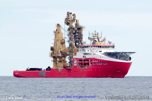
 Normand Maximus
Current Status
Where is the vessel?
Normand Maximus is currently in 44 nm E of Morant Bay, based on AIS data received about 1h ago.
Latest AIS update:
Current position: 17.98907° N, 75.65927° W (44 nm E of Morant Bay)
Average speed (last 7 days): Loading…
Average speed (last 30 days): Loading…
Vessel profile: Normand Maximus is a Offshore Support Vessel with dimensions 178m x 180m.
This page combines live AIS, route history, probable destination signals, nearby traffic, and port activity for practical vessel monitoring.
The current position of vessel Normand Maximus is 17.98907 lat / -75.65927 lng. Updated: 2026-04-15 05:47:17 UTCNearest reference points:
- 16 nm SE of Ceiba Hueca
Currently sailing under the flag of Norway ![]()
Details:
Live Vessel Normand Maximus Analytics (details, animations, etc.)
Recent AIS points (UTC):
2026-04-14 22:21:36 UTC · 18.58556, -76.98855 · SOG 11.6 kn · COG 114°2026-04-15 00:24:33 UTC · 18.41833, -76.61500 · SOG 11 kn · COG -1°
2026-04-15 03:42:35 UTC · 18.15333, -76.01667 · SOG 11 kn · COG -1°
2026-04-15 05:47:17 UTC · 17.98907, -75.65927 · SOG 11 kn · COG -1°