 vesseltracker.com
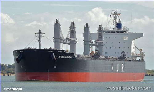
 AFRICAN FINFOOT
Current Status
Where is the vessel?
AFRICAN FINFOOT is currently in 328 nm W of Koiingnaas, based on AIS data received about 1h ago.
Latest AIS update:
Current position: 31.02645° S, 11.00869° E (328 nm W of Koiingnaas)
Average speed (last 7 days): Loading…
Average speed (last 30 days): Loading…
Vessel profile: AFRICAN FINFOOT is a Cargo with dimensions m x m.
This page combines live AIS, route history, probable destination signals, nearby traffic, and port activity for practical vessel monitoring.
The current position of vessel AFRICAN FINFOOT is -31.02645 lat / 11.00869 lng. Updated: 2026-03-26 06:23:16 UTCNearest reference points:
- 312 nm SW of Luderitz Bay
- Open sea, approx. 403 nm off the nearest listed port
- Open sea, approx. 402 nm off the nearest listed port
Currently sailing under the flag of Bahamas ![]()
Details:
Live Vessel AFRICAN FINFOOT Analytics (details, animations, etc.)
Recent AIS points (UTC):
2026-03-25 23:40:53 UTC · -30.29270, 9.68563 · SOG 11.6 kn · COG 122°2026-03-26 01:36:02 UTC · -30.49778, 10.05146 · SOG 11.9 kn · COG 122°
2026-03-26 04:02:16 UTC · -30.77290, 10.52010 · SOG 12.4 kn · COG 122°
2026-03-26 06:23:16 UTC · -31.02645, 11.00869 · SOG 12.5 kn · COG 123°