 vesseltracker.com
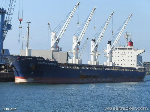
Strategic Fortitude
Current StatusWhere is the vessel?
Strategic Fortitude is currently in 46 nm S of Nangwarry, based on AIS data received about 2h ago.
Latest AIS update:
Current position: 38.29377° S, 140.57550° E (46 nm S of Nangwarry)
Average speed (last 7 days): Loading…
Average speed (last 30 days): Loading…
Vessel profile: Strategic Fortitude is a Bulk Carrier with dimensions 29m x 179m.
This page combines live AIS, route history, probable destination signals, nearby traffic, and port activity for practical vessel monitoring.
The current position of vessel Strategic Fortitude is -38.29377 lat / 140.57550 lng. Updated: 2026-03-25 19:22:07 UTCDetails:
Live Vessel Strategic Fortitude Analytics (details, animations, etc.)
Recent AIS points (UTC):
2026-03-25 14:23:07 UTC · -38.76410, 141.62383 · SOG 11.4 kn · COG 276°2026-03-25 15:35:00 UTC · -38.68031, 141.35323 · SOG 11.7 kn · COG 301°
2026-03-25 18:16:28 UTC · -38.40317, 140.79596 · SOG 11.5 kn · COG 300°
2026-03-25 19:22:07 UTC · -38.29377, 140.57550 · SOG 11.1 kn · COG 301°