 vesseltracker.com
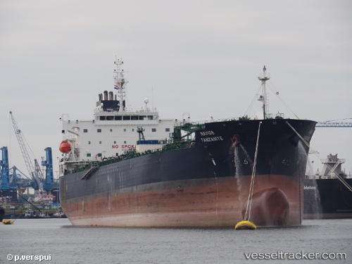
 Navig8 Tanzanite
Current Status
Where is the vessel?
Navig8 Tanzanite is currently in 156 nm S of Ehoala, based on AIS data received less than 1h ago.
Latest AIS update:
Current position: 27.65704° S, 47.02488° E (156 nm S of Ehoala)
Average speed (last 7 days): Loading…
Average speed (last 30 days): Loading…
Vessel profile: Navig8 Tanzanite is a Oil Products Tanker with dimensions 183m x 32m.
This page combines live AIS, route history, probable destination signals, nearby traffic, and port activity for practical vessel monitoring.
The current position of vessel Navig8 Tanzanite is -27.65704 lat / 47.02488 lng. Updated: 2026-04-15 07:36:56 UTCNearest reference points:
- 174 nm S of Ambovombe
- 106 nm S of Tsiombe
- 70 nm SW of Tsiombe
Currently sailing under the flag of Marshall Is ![]()
Details:
Live Vessel Navig8 Tanzanite Analytics (details, animations, etc.)
Recent AIS points (UTC):
2026-04-15 01:18:27 UTC · -28.29615, 45.80494 · SOG 11.3 kn · COG -1°2026-04-15 03:27:38 UTC · -28.08219, 46.21105 · SOG 11.8 kn · COG 58°
2026-04-15 05:42:56 UTC · -27.86668, 46.64704 · SOG 12.4 kn · COG 65°
2026-04-15 07:36:56 UTC · -27.65704, 47.02488 · SOG 12.9 kn · COG 50°