 vesseltracker.com
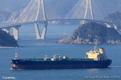
Cabo Kamui
Current StatusWhere is the vessel?
Cabo Kamui is currently in Near Oquendo, based on AIS data received about 1h ago.
Latest AIS update:
Current position: 11.98699° S, 77.18775° W (Near Oquendo)
Average speed (last 7 days): Loading…
Average speed (last 30 days): Loading…
Vessel profile: Cabo Kamui is a Crude Oil Tanker with dimensions 32m x 228m.
This page combines live AIS, route history, probable destination signals, nearby traffic, and port activity for practical vessel monitoring.
The current position of vessel Cabo Kamui is -11.98699 lat / -77.18775 lng. Updated: 2026-04-19 11:57:20 UTCNearest reference points:
- Near Callao
- 43 nm SW of Barranca
- 125 nm SW of Supe Bay
Details:
Live Vessel Cabo Kamui Analytics (details, animations, etc.)
Recent AIS points (UTC):
2026-04-19 07:57:20 UTC · -11.98655, -77.18728 · SOG 0.3 kn · COG 307°2026-04-19 09:39:21 UTC · -11.98660, -77.18739 · SOG 0.1 kn · COG 307°
2026-04-19 10:06:18 UTC · -11.98662, -77.18739 · SOG 0.1 kn · COG 304°
2026-04-19 11:57:20 UTC · -11.98699, -77.18775 · SOG 0.1 kn · COG 317°