 vesseltracker.com
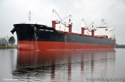
 Port Vera Cruz
Current Status
Where is the vessel?
Port Vera Cruz is currently in 398 nm W of Sungai Besi, based on AIS data received about 9h ago.
Latest AIS update:
Current position: 3.58500° N, 108.31500° W (398 nm W of Sungai Besi)
Average speed (last 7 days): Loading…
Average speed (last 30 days): Loading…
Vessel profile: Port Vera Cruz is a Bulk Carrier with dimensions 199m x 32m.
This page combines live AIS, route history, probable destination signals, nearby traffic, and port activity for practical vessel monitoring.
The current position of vessel Port Vera Cruz is 3.58500 lat / -108.31500 lng. Updated: 2026-04-10 07:26:51 UTCNearest reference points:
- Open sea (no nearby ports in database)
- Open sea, approx. 408 nm off the nearest listed port
- Open sea, approx. 412 nm off the nearest listed port
Currently sailing under the flag of Liberia ![]()
Details:
Live Vessel Port Vera Cruz Analytics (details, animations, etc.)
Recent AIS points (UTC):
2026-04-10 02:38:52 UTC · 4.50500, -108.78667 · SOG 12 kn · COG -1°2026-04-10 04:24:43 UTC · 4.16891, -108.61611 · SOG 12.8 kn · COG 150°
2026-04-10 05:28:49 UTC · 3.96315, -108.51097 · SOG 12.8 kn · COG 151°
2026-04-10 07:26:51 UTC · 3.58500, -108.31500 · SOG 13 kn · COG -1°