 vesseltracker.com
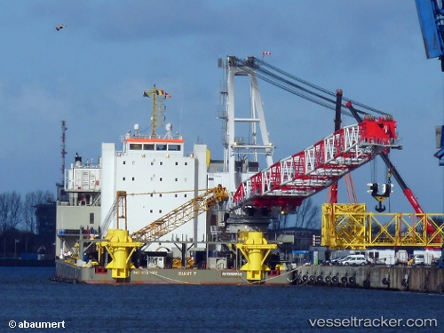
 Giant 7
Current Status
Where is the vessel?
Giant 7 is currently in Near Rotterdam, based on AIS data received about 1h ago.
Latest AIS update:
Current position: 51.88674° N, 4.45160° E (Near Rotterdam)
Average speed (last 7 days): Loading…
Average speed (last 30 days): Loading…
Vessel profile: Giant 7 is a Heavy Load Carrier with dimensions 137m x 36m.
This page combines live AIS, route history, probable destination signals, nearby traffic, and port activity for practical vessel monitoring.
The current position of vessel Giant 7 is 51.88674 lat / 4.45160 lng. Updated: 2026-04-12 15:29:19 UTCNearest reference points:
- Near Rotterdam
- Near ROTTERDAM WAALHAVEN
- Near DELFSHAVEN
Currently sailing under the flag of Belgium ![]()
Details:
Live Vessel Giant 7 Analytics (details, animations, etc.)
Recent AIS points (UTC):
2026-04-12 10:47:17 UTC · 51.88675, 4.45160 · SOG 0 kn · COG -1°2026-04-12 11:53:19 UTC · 51.88678, 4.45165 · SOG 0 kn · COG -1°
2026-04-12 13:26:18 UTC · 51.88678, 4.45166 · SOG 0 kn · COG -1°
2026-04-12 15:29:19 UTC · 51.88674, 4.45160 · SOG 0 kn · COG -1°