 vesseltracker.com
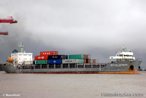
Meratus Katingan
Current StatusWhere is the vessel?
Meratus Katingan is currently in 13 nm NW of PONTIANAK, based on AIS data received about 9h ago.
Latest AIS update:
Current position: 0.07979° N, 109.14337° E (13 nm NW of PONTIANAK)
Average speed (last 7 days): Loading…
Average speed (last 30 days): Loading…
Vessel profile: Meratus Katingan is a Container Ship with dimensions 22m x 120m.
This page combines live AIS, route history, probable destination signals, nearby traffic, and port activity for practical vessel monitoring.
The current position of vessel Meratus Katingan is 0.07979 lat / 109.14337 lng. Updated: 2026-04-17 08:32:30 UTCNearest reference points:
- 12 nm SE of PONTIANAK
- 17 nm SW of Sanggau
- 81 nm N of Belitung
Details:
Live Vessel Meratus Katingan Analytics (details, animations, etc.)
Recent AIS points (UTC):
2026-04-17 07:30:22 UTC · 0.00937, 109.27908 · SOG 9 kn · COG 301°2026-04-17 08:32:30 UTC · 0.07979, 109.14337 · SOG 7.3 kn · COG 285°
2026-04-17 08:32:30 UTC · 0.07979, 109.14337 · SOG 7.3 kn · COG 285°
2026-04-17 08:32:30 UTC · 0.07979, 109.14337 · SOG 7.3 kn · COG 285°