 vesseltracker.com
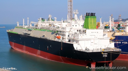
 Myrina
Current Status
Where is the vessel?
Myrina is currently in 47 nm NW of Vedado, based on AIS data received less than 1h ago.
Latest AIS update:
Current position: 23.67984° N, 83.99542° W (47 nm NW of Vedado)
Average speed (last 7 days): Loading…
Average speed (last 30 days): Loading…
Vessel profile: Myrina is a Lng Tanker with dimensions 295m x 46m.
This page combines live AIS, route history, probable destination signals, nearby traffic, and port activity for practical vessel monitoring.
The current position of vessel Myrina is 23.67984 lat / -83.99542 lng. Updated: 2026-04-22 18:35:14 UTCNearest reference points:
- 14 nm W of Florida Straits
- 40 nm S of Florida Straits
- Near Mariel
Currently sailing under the flag of Bahamas ![]()
Details:
Live Vessel Myrina Analytics (details, animations, etc.)
Recent AIS points (UTC):
2026-04-22 16:00:57 UTC · 23.80655, -84.81471 · SOG 17.9 kn · COG 117°2026-04-22 16:45:37 UTC · 23.72944, -84.59919 · SOG 17.7 kn · COG -1°
2026-04-22 18:05:44 UTC · 23.69255, -84.16589 · SOG 18 kn · COG -1°
2026-04-22 18:35:14 UTC · 23.67984, -83.99542 · SOG 17.8 kn · COG 99°