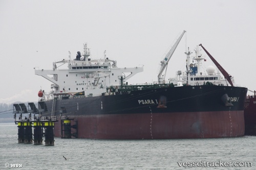
Psara I
Current StatusWhere is the vessel?
Psara I is currently in 59 nm NE of Dai Hung (Tandem Load), based on AIS data received about 14h ago.
Latest AIS update:
Current position: 9.05166° N, 109.47500° E (59 nm NE of Dai Hung (Tandem Load))
Average speed (last 7 days): Loading…
Average speed (last 30 days): Loading…
Vessel profile: Psara I is a Crude Oil Tanker with dimensions 48m x 274m.
This page combines live AIS, route history, probable destination signals, nearby traffic, and port activity for practical vessel monitoring.
The current position of vessel Psara I is 9.05166 lat / 109.47500 lng. Updated: 2026-05-23 13:26:29 UTCNearest reference points:
- Near Rang Dong
- 30 nm SW of Dai Hung (Tandem Load)
- 41 nm NW of Brebes
Details:
Live Vessel Psara I Analytics (details, animations, etc.)
Recent AIS points (UTC):
2026-05-23 10:23:46 UTC · 9.53527, 109.89761 · SOG 12.4 kn · COG 222°2026-05-23 12:17:24 UTC · 9.23333, 109.63500 · SOG 12 kn · COG -1°
2026-05-23 13:20:25 UTC · 9.06833, 109.48667 · SOG 12 kn · COG -1°
2026-05-23 13:26:29 UTC · 9.05166, 109.47500 · SOG 12 kn · COG -1°