 vesseltracker.com
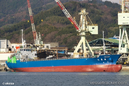
 Taihoumaru
Current Status
Where is the vessel?
Taihoumaru is currently in Near Kinuura, based on AIS data received less than 1h ago.
Latest AIS update:
Current position: 34.80192° N, 136.94151° E (Near Kinuura)
Average speed (last 7 days): Loading…
Average speed (last 30 days): Loading…
Vessel profile: Taihoumaru is a General Cargo Ship with dimensions 75m x 12m.
This page combines live AIS, route history, probable destination signals, nearby traffic, and port activity for practical vessel monitoring.
The current position of vessel Taihoumaru is 34.80192 lat / 136.94151 lng. Updated: 2026-04-21 21:52:07 UTCNearest reference points:
- Near Kinuura
- Near Mihama
- Near Atumi
Currently sailing under the flag of Japan ![]()
Details:
Live Vessel Taihoumaru Analytics (details, animations, etc.)
Recent AIS points (UTC):
2026-04-21 18:07:12 UTC · 34.54667, 137.37833 · SOG 12 kn · COG -1°2026-04-21 19:39:06 UTC · 34.55349, 137.02254 · SOG 9.5 kn · COG 310°
2026-04-21 20:18:26 UTC · 34.63975, 136.97632 · SOG 8.6 kn · COG 7°
2026-04-21 21:52:07 UTC · 34.80192, 136.94151 · SOG 0 kn · COG 342°