 vesseltracker.com
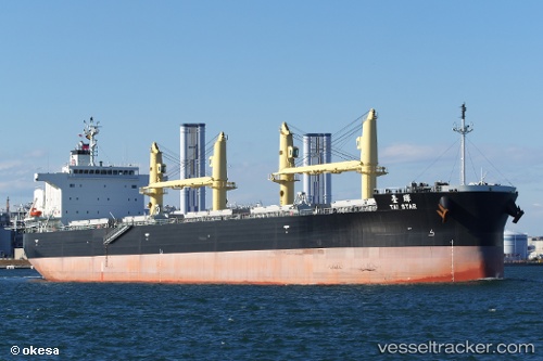
Tai Star
Current StatusWhere is the vessel?
Tai Star is currently in Near Antwerp, based on AIS data received about 2h ago.
Latest AIS update:
Current position: 51.25834° N, 4.41275° E (Near Antwerp)
Average speed (last 7 days): Loading…
Average speed (last 30 days): Loading…
Vessel profile: Tai Star is a Bulk Carrier with dimensions 32m x 200m.
This page combines live AIS, route history, probable destination signals, nearby traffic, and port activity for practical vessel monitoring.
The current position of vessel Tai Star is 51.25834 lat / 4.41275 lng. Updated: 2026-03-27 23:32:50 UTCNearest reference points:
- Near Antwerp
- Near Kruibeke
- Near WIJNEGEM
Details:
Live Vessel Tai Star Analytics (details, animations, etc.)
Recent AIS points (UTC):
2026-03-27 17:52:23 UTC · 51.25834, 4.41273 · SOG 0.2 kn · COG 268°2026-03-27 20:05:39 UTC · 51.25834, 4.41272 · SOG 0.1 kn · COG 268°
2026-03-27 21:32:39 UTC · 51.25834, 4.41269 · SOG 0 kn · COG 268°
2026-03-27 23:32:50 UTC · 51.25834, 4.41275 · SOG 0.1 kn · COG -1°