 vesseltracker.com
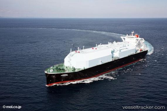
 Lng Juno
Current Status
Where is the vessel?
Lng Juno is currently in Open sea, approx. 408 nm off the nearest listed port, based on AIS data received less than 1h ago.
Latest AIS update:
Current position: 17.75833° N, 51.92333° W (Open sea, approx. 408 nm off the nearest listed port)
Average speed (last 7 days): Loading…
Average speed (last 30 days): Loading…
Vessel profile: Lng Juno is a Lng Tanker with dimensions 298m x 298m.
This page combines live AIS, route history, probable destination signals, nearby traffic, and port activity for practical vessel monitoring.
The current position of vessel Lng Juno is 17.75833 lat / -51.92333 lng. Updated: 2026-04-17 03:23:12 UTCNearest reference points:
- Open sea, approx. 408 nm off the nearest listed port
- Open sea, approx. 410 nm off the nearest listed port
- Open sea, approx. 407 nm off the nearest listed port
Currently sailing under the flag of Bahamas ![]()
Details:
Live Vessel Lng Juno Analytics (details, animations, etc.)
Recent AIS points (UTC):
2026-04-16 21:47:12 UTC · 18.54667, -50.73667 · SOG 14 kn · COG -1°2026-04-16 23:59:57 UTC · 18.23729, -51.20265 · SOG 14.7 kn · COG 233°
2026-04-17 01:23:11 UTC · 18.04333, -51.49667 · SOG 14 kn · COG -1°
2026-04-17 03:23:12 UTC · 17.75833, -51.92333 · SOG 15 kn · COG -1°