 vesseltracker.com
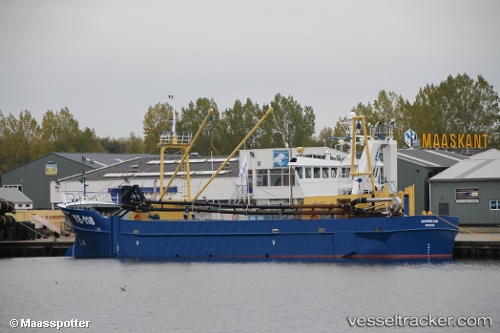
 Ye 118 Noordland
Current Status
Where is the vessel?
Ye 118 Noordland is currently in Near NEELTJE JANS, based on AIS data received less than 1h ago.
Latest AIS update:
Current position: 51.62057° N, 3.68159° E (Near NEELTJE JANS)
Average speed (last 7 days): Loading…
Average speed (last 30 days): Loading…
Vessel profile: Ye 118 Noordland is a Fishing Vessel with dimensions 43m x 9m.
This page combines live AIS, route history, probable destination signals, nearby traffic, and port activity for practical vessel monitoring.
The current position of vessel Ye 118 Noordland is 51.62057 lat / 3.68159 lng. Updated: 2026-04-23 03:29:04 UTCNearest reference points:
- Near NEELTJE JANS
- Near OOSTWATERING
- Near BASTIAAN DE LANGEPLA
Currently sailing under the flag of Netherlands ![]()
Details:
Live Vessel Ye 118 Noordland Analytics (details, animations, etc.)
Recent AIS points (UTC):
2026-04-23 00:14:25 UTC · 51.60436, 3.39947 · SOG 1 kn · COG 260°2026-04-23 01:10:15 UTC · 51.60556, 3.40440 · SOG 0.7 kn · COG 250°
2026-04-23 01:28:55 UTC · 51.60356, 3.40094 · SOG 0.6 kn · COG 247°
2026-04-23 03:29:04 UTC · 51.62057, 3.68159 · SOG 0 kn · COG 278°