 vesseltracker.com
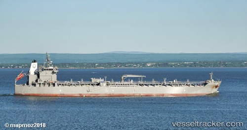
 SL HAWAII
Current Status
Where is the vessel?
SL HAWAII is currently in Open sea, approx. 408 nm off the nearest listed port, based on AIS data received about 4d ago.
Latest AIS update:
Current position: 0.24578° S, 84.26338° E (Open sea, approx. 408 nm off the nearest listed port)
Average speed (last 7 days): Loading…
Average speed (last 30 days): Loading…
Vessel profile: SL HAWAII is a Tanker with dimensions m x m.
This page combines live AIS, route history, probable destination signals, nearby traffic, and port activity for practical vessel monitoring.
The current position of vessel SL HAWAII is -0.24578 lat / 84.26338 lng. Updated: 2026-03-31 03:19:47 UTCNearest reference points:
- Open sea, approx. 408 nm off the nearest listed port
- Open sea, approx. 402 nm off the nearest listed port
- Open sea, approx. 403 nm off the nearest listed port
Currently sailing under the flag of United States ![]()
Details:
Live Vessel SL HAWAII Analytics (details, animations, etc.)
Recent AIS points (UTC):
2026-03-31 01:41:22 UTC · -0.06591, 84.59286 · SOG 13.7 kn · COG 238°2026-03-31 03:19:47 UTC · -0.24578, 84.26338 · SOG 13.9 kn · COG 236°
2026-03-31 03:19:47 UTC · -0.24578, 84.26338 · SOG 13.9 kn · COG 236°
2026-03-31 03:19:47 UTC · -0.24578, 84.26338 · SOG 13.9 kn · COG 236°