 vesseltracker.com
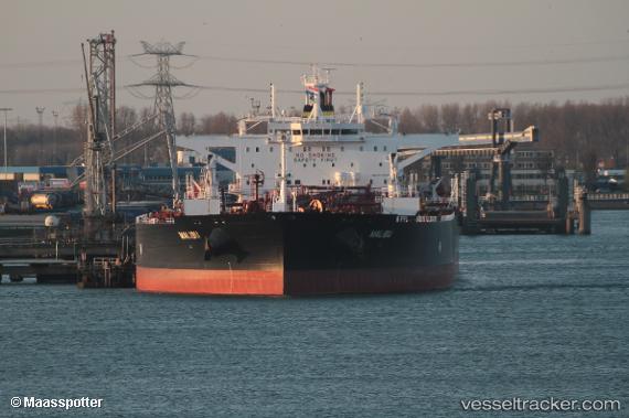
Malibu
Current StatusWhere is the vessel?
Malibu is currently in Near Cpc Terminal, based on AIS data received about 2h ago.
Latest AIS update:
Current position: 44.51425° N, 37.61836° E (Near Cpc Terminal)
Average speed (last 7 days): Loading…
Average speed (last 30 days): Loading…
Vessel profile: Malibu is a Crude Oil Tanker with dimensions 49m x 279m.
This page combines live AIS, route history, probable destination signals, nearby traffic, and port activity for practical vessel monitoring.
The current position of vessel Malibu is 44.51425 lat / 37.61836 lng. Updated: 2026-04-19 14:19:46 UTCNearest reference points:
- Near Cpc Terminal
- 20 nm S of Cpc Terminal
- Near Novorossiysk
Details:
Live Vessel Malibu Analytics (details, animations, etc.)
Recent AIS points (UTC):
2026-04-19 12:04:51 UTC · 44.71143, 37.84760 · SOG 20.3 kn · COG 199°2026-04-19 14:19:46 UTC · 44.51425, 37.61836 · SOG 9.9 kn · COG 197°
2026-04-19 14:19:46 UTC · 44.51425, 37.61836 · SOG 9.9 kn · COG 197°
2026-04-19 14:19:46 UTC · 44.51425, 37.61836 · SOG 9.9 kn · COG 197°