 vesseltracker.com
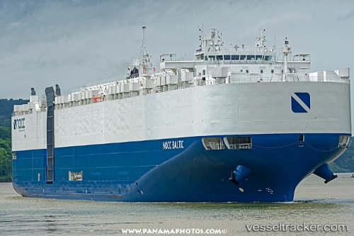
 Liberty Peace
Current Status
Where is the vessel?
Liberty Peace is currently in Near Blount Island, based on AIS data received about 1h ago.
Latest AIS update:
Current position: 30.39691° N, 81.56870° W (Near Blount Island)
Average speed (last 7 days): Loading…
Average speed (last 30 days): Loading…
Vessel profile: Liberty Peace is a Vehicles Carrier with dimensions 199m x 199m.
This page combines live AIS, route history, probable destination signals, nearby traffic, and port activity for practical vessel monitoring.
The current position of vessel Liberty Peace is 30.39691 lat / -81.56870 lng. Updated: 2026-04-21 13:38:35 UTCNearest reference points:
- Near Jacksonville
- Near Fernandina
- Near Ponte Vedra
Currently sailing under the flag of USA ![]()
Details:
Live Vessel Liberty Peace Analytics (details, animations, etc.)
Recent AIS points (UTC):
2026-04-21 09:29:35 UTC · 30.39690, -81.56871 · SOG 0 kn · COG 327°2026-04-21 11:53:35 UTC · 30.39692, -81.56872 · SOG 0 kn · COG 327°
2026-04-21 13:17:35 UTC · 30.39693, -81.56870 · SOG 0 kn · COG 327°
2026-04-21 13:38:35 UTC · 30.39691, -81.56870 · SOG 0 kn · COG 327°