 vesseltracker.com
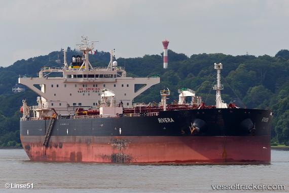
 Rivera
Current Status
Where is the vessel?
Rivera is currently in 47 nm E of Kakap Natuna Terminal, based on AIS data received less than 1h ago.
Latest AIS update:
Current position: 4.92500° N, 106.73333° E (47 nm E of Kakap Natuna Terminal)
Average speed (last 7 days): Loading…
Average speed (last 30 days): Loading…
Vessel profile: Rivera is a Crude Oil Tanker with dimensions 250m x 250m.
This page combines live AIS, route history, probable destination signals, nearby traffic, and port activity for practical vessel monitoring.
The current position of vessel Rivera is 4.92500 lat / 106.73333 lng. Updated: 2026-04-16 23:49:47 UTCNearest reference points:
- 46 nm E of Kakap Natuna Terminal
- 45 nm E of Kakap Natuna Terminal
- 36 nm SW of Slipi
Currently sailing under the flag of Liberia ![]()
Rivera built in 0 year
Deadweight:
0 tDetails:
Live Vessel Rivera Analytics (details, animations, etc.)
Recent AIS points (UTC):
2026-04-16 17:21:56 UTC · 5.93770, 107.68336 · SOG 12.3 kn · COG 219°2026-04-16 19:43:46 UTC · 5.57167, 107.34667 · SOG 12 kn · COG -1°
2026-04-16 21:19:44 UTC · 5.32667, 107.10667 · SOG 12 kn · COG -1°
2026-04-16 23:49:47 UTC · 4.92500, 106.73333 · SOG 13 kn · COG -1°