 vesseltracker.com
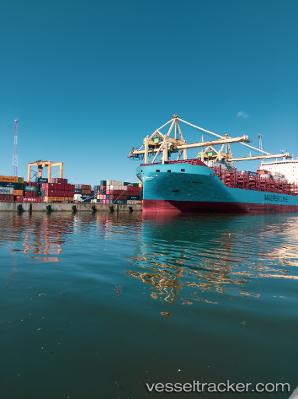
 Vaga Maersk
Current Status
Where is the vessel?
Vaga Maersk is currently in 40 nm NE of Estombar, based on AIS data received about 1h ago.
Latest AIS update:
Current position: 37.66083° N, 9.00620° E (40 nm NE of Estombar)
Average speed (last 7 days): Loading…
Average speed (last 30 days): Loading…
Vessel profile: Vaga Maersk is a Container Ship with dimensions 200m x 36m.
This page combines live AIS, route history, probable destination signals, nearby traffic, and port activity for practical vessel monitoring.
The current position of vessel Vaga Maersk is 37.66083 lat / 9.00620 lng. Updated: 2026-04-18 17:33:23 UTCNearest reference points:
- 35 nm S of Setubal
- 33 nm SE of Setubal
- Near SARROCH
Currently sailing under the flag of Denmark ![]()
Details:
Live Vessel Vaga Maersk Analytics (details, animations, etc.)
Recent AIS points (UTC):
2026-04-18 12:21:10 UTC · 37.49335, 7.51558 · SOG 14.5 kn · COG 80°2026-04-18 14:02:30 UTC · 37.54870, 8.00802 · SOG 13.9 kn · COG 86°
2026-04-18 16:21:17 UTC · 37.61223, 8.66648 · SOG 13.5 kn · COG 76°
2026-04-18 17:33:23 UTC · 37.66083, 9.00620 · SOG 13.7 kn · COG 86°