 vesseltracker.com
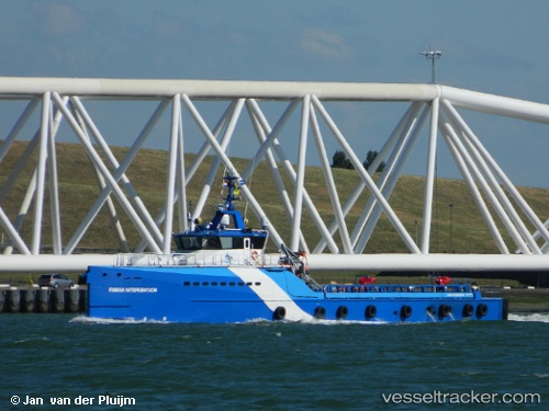
 FAMAR INTERVENTION
Current Status
Where is the vessel?
FAMAR INTERVENTION is currently in Near Pointe Noire, based on AIS data received about 3h ago.
Latest AIS update:
Current position: 4.78168° S, 11.85001° E (Near Pointe Noire)
Average speed (last 7 days): Loading…
Average speed (last 30 days): Loading…
Vessel profile: FAMAR INTERVENTION is a Other Type with dimensions m x m.
This page combines live AIS, route history, probable destination signals, nearby traffic, and port activity for practical vessel monitoring.
The current position of vessel FAMAR INTERVENTION is -4.78168 lat / 11.85001 lng. Updated: 2026-04-08 19:12:13 UTCNearest reference points:
- Near Pointe Noire
- Near Futila Terminal
- Near N'Kossa Terminal
Details:
Live Vessel FAMAR INTERVENTION Analytics (details, animations, etc.)
Recent AIS points (UTC):
2026-04-08 13:57:55 UTC · -4.78059, 11.85042 · SOG 0 kn · COG 285°2026-04-08 16:09:55 UTC · -4.78060, 11.85043 · SOG 0 kn · COG 285°
2026-04-08 17:37:48 UTC · -4.78095, 11.85033 · SOG 0 kn · COG 286°
2026-04-08 19:12:13 UTC · -4.78168, 11.85001 · SOG 0 kn · COG 285°