 vesseltracker.com
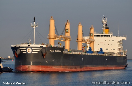
 RED SAKURA
Current Status
Where is the vessel?
RED SAKURA is currently in Near Curtis Bay, Baltimore, based on AIS data received less than 1h ago.
Latest AIS update:
Current position: 39.22287° N, 76.57759° W (Near Curtis Bay, Baltimore)
Average speed (last 7 days): Loading…
Average speed (last 30 days): Loading…
Vessel profile: RED SAKURA is a Bulk Carrier with dimensions 32m x 200m.
This page combines live AIS, route history, probable destination signals, nearby traffic, and port activity for practical vessel monitoring.
The current position of vessel RED SAKURA is 39.22287 lat / -76.57759 lng. Updated: 2026-04-02 01:28:41 UTCNearest reference points:
- Near Curtis Bay, Baltimore
- Near Arundel Village
- Near South Baltimore
Currently sailing under the flag of Liberia ![]()
RED SAKURA built in 2017 year
Deadweight:
60245 tDetails:
Live Vessel RED SAKURA Analytics (details, animations, etc.)
Recent AIS points (UTC):
2026-04-01 19:54:48 UTC · 38.93892, -76.41420 · SOG 0 kn · COG 165°2026-04-01 21:43:00 UTC · 38.97088, -76.39060 · SOG 12.9 kn · COG 16°
2026-04-01 23:53:40 UTC · 39.22277, -76.57733 · SOG 0.7 kn · COG 272°
2026-04-02 01:28:41 UTC · 39.22287, -76.57759 · SOG 0 kn · COG 271°