 vesseltracker.com
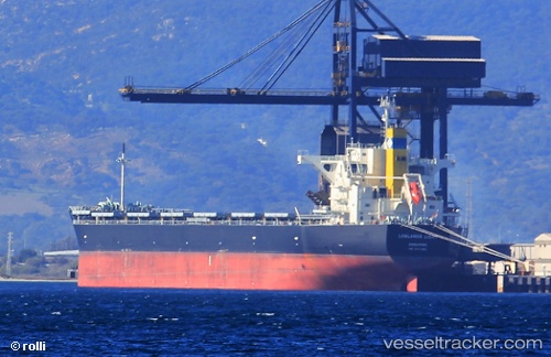
 MEDI AMALFI
Current Status
Where is the vessel?
MEDI AMALFI is currently in 29 nm S of Fuengirola, based on AIS data received about 1h ago.
Latest AIS update:
Current position: 36.08109° N, 4.43276° W (29 nm S of Fuengirola)
Average speed (last 7 days): Loading…
Average speed (last 30 days): Loading…
Vessel profile: MEDI AMALFI is a Bulk Carrier with dimensions 36m x 228m.
This page combines live AIS, route history, probable destination signals, nearby traffic, and port activity for practical vessel monitoring.
The current position of vessel MEDI AMALFI is 36.08109 lat / -4.43276 lng. Updated: 2026-04-02 11:26:22 UTCNearest reference points:
- 31 nm SE of Fuengirola
- 30 nm E of Ceuta
- Near Fuengirola
Currently sailing under the flag of Liberia ![]()
MEDI AMALFI built in 2017 year
Deadweight:
87605 tDetails:
Live Vessel MEDI AMALFI Analytics (details, animations, etc.)
Recent AIS points (UTC):
2026-04-02 05:46:36 UTC · 35.89122, -5.74816 · SOG 14.4 kn · COG 82°2026-04-02 08:01:40 UTC · 36.01553, -5.11536 · SOG 11.7 kn · COG 72°
2026-04-02 10:08:53 UTC · 36.05684, -4.67658 · SOG 9.5 kn · COG 85°
2026-04-02 11:26:22 UTC · 36.08109, -4.43276 · SOG 8.7 kn · COG 81°