 vesseltracker.com
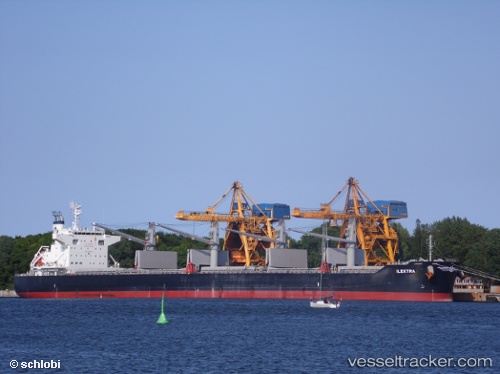
Ilektra
Current StatusWhere is the vessel?
Ilektra is currently in 278 nm SW of Tsiombe, based on AIS data received less than 1h ago.
Latest AIS update:
Current position: 27.33429° S, 40.83843° E (278 nm SW of Tsiombe)
Average speed (last 7 days): Loading…
Average speed (last 30 days): Loading…
Vessel profile: Ilektra is a Bulk Carrier with dimensions 32m x 199m.
This page combines live AIS, route history, probable destination signals, nearby traffic, and port activity for practical vessel monitoring.
The current position of vessel Ilektra is -27.33429 lat / 40.83843 lng. Updated: 2026-04-01 23:45:48 UTCNearest reference points:
- Open sea, approx. 401 nm off the nearest listed port
- 358 nm E of Richards Bay
- Open sea, approx. 403 nm off the nearest listed port
Details:
Live Vessel Ilektra Analytics (details, animations, etc.)
Recent AIS points (UTC):
2026-04-01 17:22:47 UTC · -27.11984, 42.15251 · SOG 11.9 kn · COG 258°2026-04-01 19:46:07 UTC · -27.20627, 41.65266 · SOG 11.2 kn · COG 255°
2026-04-01 21:56:48 UTC · -27.27137, 41.21022 · SOG 11 kn · COG 257°
2026-04-01 23:45:48 UTC · -27.33429, 40.83843 · SOG 11.1 kn · COG 257°