 vesseltracker.com
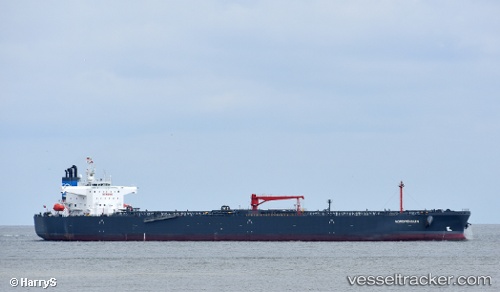
 Nordpenguin
Current Status
Where is the vessel?
Nordpenguin is currently in 362 nm S of Shitan, based on AIS data received less than 1h ago.
Latest AIS update:
Current position: 17.45890° N, 115.74196° W (362 nm S of Shitan)
Average speed (last 7 days): Loading…
Average speed (last 30 days): Loading…
Vessel profile: Nordpenguin is a Crude Oil Tanker with dimensions 237m x 44m.
This page combines live AIS, route history, probable destination signals, nearby traffic, and port activity for practical vessel monitoring.
The current position of vessel Nordpenguin is 17.45890 lat / -115.74196 lng. Updated: 2026-04-12 09:52:45 UTCNearest reference points:
- Open sea, approx. 402 nm off the nearest listed port
- Open sea, approx. 408 nm off the nearest listed port
- Open sea, approx. 500 nm off the nearest listed port
Currently sailing under the flag of Portugal ![]()
Details:
Live Vessel Nordpenguin Analytics (details, animations, etc.)
Recent AIS points (UTC):
2026-04-10 07:54:24 UTC · 27.48326, -116.88491 · SOG 12.1 kn · COG 172°2026-04-12 06:42:47 UTC · 18.05535, -115.80261 · SOG 11.9 kn · COG 173°
2026-04-12 07:22:58 UTC · 17.92526, -115.78790 · SOG 11.6 kn · COG 173°
2026-04-12 09:52:45 UTC · 17.45890, -115.74196 · SOG 11.2 kn · COG 172°