 vesseltracker.com
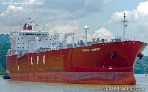
 Clipper Freeport
Current Status
Where is the vessel?
Clipper Freeport is currently in Open sea (no nearby ports in database), based on AIS data received about 1h ago.
Latest AIS update:
Current position: 11.74244° N, 127.41708° W (Open sea (no nearby ports in database))
Average speed (last 7 days): Loading…
Average speed (last 30 days): Loading…
Vessel profile: Clipper Freeport is a Lpg Tanker with dimensions 230m x 32m.
This page combines live AIS, route history, probable destination signals, nearby traffic, and port activity for practical vessel monitoring.
The current position of vessel Clipper Freeport is 11.74244 lat / -127.41708 lng. Updated: 2026-04-20 07:20:41 UTCNearest reference points:
- Open sea (no nearby ports in database)
Currently sailing under the flag of Norway ![]()
Details:
Live Vessel Clipper Freeport Analytics (details, animations, etc.)
Recent AIS points (UTC):
2026-04-20 04:33:08 UTC · 11.65546, -126.69243 · SOG 15.3 kn · COG 274°2026-04-20 05:56:56 UTC · 11.69788, -127.05719 · SOG 15.2 kn · COG 274°
2026-04-20 07:18:13 UTC · 11.74126, -127.40729 · SOG 15.1 kn · COG 274°
2026-04-20 07:20:41 UTC · 11.74244, -127.41708 · SOG 15 kn · COG 274°