 vesseltracker.com
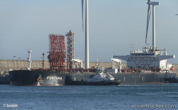
 FONTANA
Current Status
Where is the vessel?
FONTANA is currently in 17 nm S of Carry-le-Rouet, based on AIS data received less than 1h ago.
Latest AIS update:
Current position: 43.05788° N, 5.12861° E (17 nm S of Carry-le-Rouet)
Average speed (last 7 days): Loading…
Average speed (last 30 days): Loading…
Vessel profile: FONTANA is a Crude Oil Tanker with dimensions 274m x 48m.
This page combines live AIS, route history, probable destination signals, nearby traffic, and port activity for practical vessel monitoring.
The current position of vessel FONTANA is 43.05788 lat / 5.12861 lng. Updated: 2026-04-03 09:47:50 UTCNearest reference points:
- 23 nm SW of Toulon
- Near Le Canet
- Near Marseille
Currently sailing under the flag of Marshall Islands ![]()
FONTANA built in 2017 year
Deadweight:
159541 tDetails:
Live Vessel FONTANA Analytics (details, animations, etc.)
Recent AIS points (UTC):
2026-04-03 03:14:33 UTC · 42.09833, 5.76167 · SOG 9 kn · COG -1°2026-04-03 05:29:33 UTC · 42.41167, 5.54167 · SOG 9 kn · COG -1°
2026-04-03 07:57:31 UTC · 42.76893, 5.31536 · SOG 10.2 kn · COG 336°
2026-04-03 09:47:50 UTC · 43.05788, 5.12861 · SOG 10.9 kn · COG 339°