 vesseltracker.com
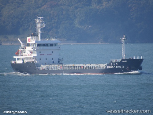
 Keum Yang 2
Current Status
Where is the vessel?
Keum Yang 2 is currently in Near KIMITSU, based on AIS data received about 2h ago.
Latest AIS update:
Current position: 35.35475° N, 139.85422° E (Near KIMITSU)
Average speed (last 7 days): Loading…
Average speed (last 30 days): Loading…
Vessel profile: Keum Yang 2 is a General Cargo Ship with dimensions 80m x 80m.
This page combines live AIS, route history, probable destination signals, nearby traffic, and port activity for practical vessel monitoring.
The current position of vessel Keum Yang 2 is 35.35475 lat / 139.85422 lng. Updated: 2026-03-31 05:46:08 UTCNearest reference points:
- Near Yokosuka
- Near Naka-Ku, Kanagawa
- Near Kawasaki
Currently sailing under the flag of Korea ![]()
Details:
Live Vessel Keum Yang 2 Analytics (details, animations, etc.)
Recent AIS points (UTC):
2026-03-30 23:43:14 UTC · 35.35471, 139.85420 · SOG 0 kn · COG 328°2026-03-31 02:04:13 UTC · 35.35472, 139.85425 · SOG 0 kn · COG 328°
2026-03-31 04:07:16 UTC · 35.35473, 139.85422 · SOG 0 kn · COG 329°
2026-03-31 05:46:08 UTC · 35.35475, 139.85422 · SOG 0 kn · COG 328°