 vesseltracker.com
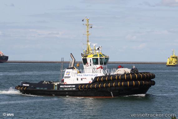
 Multratug 29
Current Status
Where is the vessel?
Multratug 29 is currently in 17 nm W of Thorntonbank, based on AIS data received less than 1h ago.
Latest AIS update:
Current position: 51.52800° N, 2.49627° E (17 nm W of Thorntonbank)
Average speed (last 7 days): Loading…
Average speed (last 30 days): Loading…
Vessel profile: Multratug 29 is a Tug with dimensions 32m x 12m.
This page combines live AIS, route history, probable destination signals, nearby traffic, and port activity for practical vessel monitoring.
The current position of vessel Multratug 29 is 51.52800 lat / 2.49627 lng. Updated: 2026-04-08 17:41:07 UTCNearest reference points:
- 13 nm NW of Middelkerke
- Near Lombardsijde
- Near Oostende
Currently sailing under the flag of Netherlands ![]()
Details:
Live Vessel Multratug 29 Analytics (details, animations, etc.)
Recent AIS points (UTC):
2026-04-08 11:59:27 UTC · 51.52809, 2.49627 · SOG 0.4 kn · COG 242°2026-04-08 14:01:07 UTC · 51.52795, 2.49645 · SOG 0 kn · COG 239°
2026-04-08 16:13:17 UTC · 51.52784, 2.49644 · SOG 0 kn · COG 244°
2026-04-08 17:41:07 UTC · 51.52800, 2.49627 · SOG 0 kn · COG 234°