 vesseltracker.com
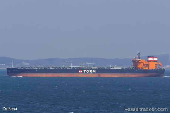
Torm Hermia
Current StatusWhere is the vessel?
Torm Hermia is currently in Near Changi, based on AIS data received about 1h ago.
Latest AIS update:
Current position: 1.28828° N, 103.99677° E (Near Changi)
Average speed (last 7 days): Loading…
Average speed (last 30 days): Loading…
Vessel profile: Torm Hermia is a Crude Oil Tanker with dimensions 44m x 250m.
This page combines live AIS, route history, probable destination signals, nearby traffic, and port activity for practical vessel monitoring.
The current position of vessel Torm Hermia is 1.28828 lat / 103.99677 lng. Updated: 2026-04-10 00:14:38 UTCNearest reference points:
- Near Changi
- Near TANAH MERAH
- Near Tampines
Details:
Live Vessel Torm Hermia Analytics (details, animations, etc.)
Recent AIS points (UTC):
2026-04-09 17:47:36 UTC · 1.28796, 103.99140 · SOG 0 kn · COG 83°2026-04-09 19:53:35 UTC · 1.28615, 103.99288 · SOG 0.2 kn · COG 14°
2026-04-09 21:59:39 UTC · 1.28730, 103.99557 · SOG 0 kn · COG 281°
2026-04-10 00:14:38 UTC · 1.28828, 103.99677 · SOG 0 kn · COG 263°