 vesseltracker.com
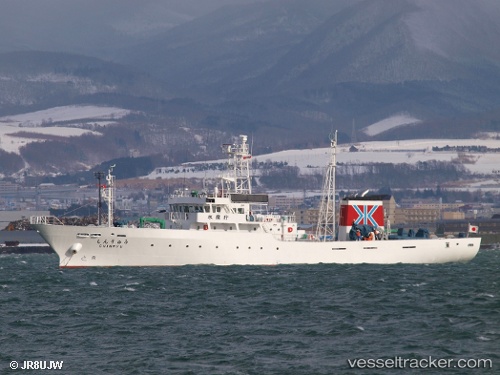
Shinryu
Current StatusWhere is the vessel?
Shinryu is currently in Near Hakodate, based on AIS data received about 6d ago.
Latest AIS update:
Current position: 41.75250° N, 140.66241° E (Near Hakodate)
Average speed (last 7 days): Loading…
Average speed (last 30 days): Loading…
Vessel profile: Shinryu is a Fishing Support Vessel with dimensions 9m x 67m.
This page combines live AIS, route history, probable destination signals, nearby traffic, and port activity for practical vessel monitoring.
The current position of vessel Shinryu is 41.75250 lat / 140.66241 lng. Updated: 2026-04-01 00:30:26 UTCNearest reference points:
- Near Muroran
- 23 nm NE of SAI
- 11 nm NW of Yokohama, Aomori
Details:
Live Vessel Shinryu Analytics (details, animations, etc.)
Recent AIS points (UTC):
2026-03-31 22:17:09 UTC · 41.77375, 140.71210 · SOG 0.1 kn · COG 129°2026-04-01 00:07:36 UTC · 41.78943, 140.71075 · SOG 8.9 kn · COG 335°
2026-04-01 00:30:26 UTC · 41.75250, 140.66241 · SOG 10.9 kn · COG 208°
2026-04-01 00:30:26 UTC · 41.75250, 140.66241 · SOG 10.9 kn · COG 208°
2026-04-01 00:30:26 UTC · 41.75250, 140.66241 · SOG 10.9 kn · COG 208°