 vesseltracker.com
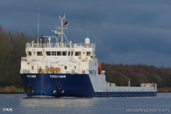
 TOPAZ ISHIM
Current Status
Where is the vessel?
TOPAZ ISHIM is currently in Near Ras Tannurah, based on AIS data received less than 1h ago.
Latest AIS update:
Current position: 26.61410° N, 50.20385° E (Near Ras Tannurah)
Average speed (last 7 days): Loading…
Average speed (last 30 days): Loading…
Vessel profile: TOPAZ ISHIM is a Heavy Load Carrier with dimensions 16m x 123m.
This page combines live AIS, route history, probable destination signals, nearby traffic, and port activity for practical vessel monitoring.
The current position of vessel TOPAZ ISHIM is 26.61410 lat / 50.20385 lng. Updated: 2026-04-19 13:34:15 UTCNearest reference points:
- Near Ad Dammam
- Near DAMMAM
- Near Sayhat
Currently sailing under the flag of Marshall Islands ![]()
TOPAZ ISHIM built in 2017 year
Deadweight:
2946 tDetails:
Live Vessel TOPAZ ISHIM Analytics (details, animations, etc.)
Recent AIS points (UTC):
2026-04-19 10:01:14 UTC · 26.61459, 50.20439 · SOG 0 kn · COG 323°2026-04-19 10:10:04 UTC · 26.61333, 50.20333 · SOG 0 kn · COG -1°
2026-04-19 11:46:14 UTC · 26.61409, 50.20393 · SOG 0 kn · COG 15°
2026-04-19 13:34:15 UTC · 26.61410, 50.20385 · SOG 0 kn · COG 25°