 vesseltracker.com
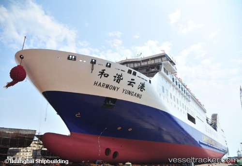
 Harmony Yungang
Current Status
Where is the vessel?
Harmony Yungang is currently in Near Lianyungang, based on AIS data received about 1h ago.
Latest AIS update:
Current position: 34.75176° N, 119.37677° E (Near Lianyungang)
Average speed (last 7 days): Loading…
Average speed (last 30 days): Loading…
Vessel profile: Harmony Yungang is a Passenger Ro Ro Cargo Ship with dimensions 196m x 28m.
This page combines live AIS, route history, probable destination signals, nearby traffic, and port activity for practical vessel monitoring.
The current position of vessel Harmony Yungang is 34.75176 lat / 119.37677 lng. Updated: 2026-04-02 19:38:18 UTCNearest reference points:
- Near Lianyungang
- 12 nm SE of Lianyungang
- Near Lanshan Pt
Currently sailing under the flag of Panama ![]()
Details:
Live Vessel Harmony Yungang Analytics (details, animations, etc.)
Recent AIS points (UTC):
2026-04-02 13:35:18 UTC · 34.75178, 119.37676 · SOG 0.1 kn · COG 101°2026-04-02 15:32:18 UTC · 34.75174, 119.37678 · SOG 0 kn · COG 101°
2026-04-02 17:23:18 UTC · 34.75176, 119.37676 · SOG 0 kn · COG 101°
2026-04-02 19:38:18 UTC · 34.75176, 119.37677 · SOG 0 kn · COG 101°