 vesseltracker.com
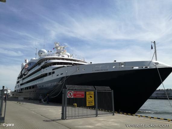
 Le Dumont Durville
Current Status
Where is the vessel?
Le Dumont Durville is currently in Near Licodia Eubea, based on AIS data received about 1d ago.
Latest AIS update:
Current position: 37.17299° N, 15.50603° E (Near Licodia Eubea)
Average speed (last 7 days): Loading…
Average speed (last 30 days): Loading…
Vessel profile: Le Dumont Durville is a Cruise Ship with dimensions 131m x 18m.
This page combines live AIS, route history, probable destination signals, nearby traffic, and port activity for practical vessel monitoring.
The current position of vessel Le Dumont Durville is 37.17299 lat / 15.50603 lng. Updated: 2026-04-10 07:24:26 UTCNearest reference points:
- Near Siracusa
- Near SANTA PANAGIA
- Near Pier Isab
Currently sailing under the flag of Wallis Futuna Is ![]()
Details:
Live Vessel Le Dumont Durville Analytics (details, animations, etc.)
Recent AIS points (UTC):
2026-04-10 02:27:45 UTC · 38.04159, 16.39391 · SOG 13.7 kn · COG 221°2026-04-10 03:48:35 UTC · 37.80470, 16.15187 · SOG 13.9 kn · COG 222°
2026-04-10 06:01:34 UTC · 37.41550, 15.75329 · SOG 13.6 kn · COG 220°
2026-04-10 07:24:26 UTC · 37.17299, 15.50603 · SOG 13.9 kn · COG 224°