 vesseltracker.com
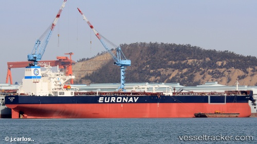
 Cap Quebec
Current Status
Where is the vessel?
Cap Quebec is currently in 89 nm N of Elizabeth, based on AIS data received about 1h ago.
Latest AIS update:
Current position: 21.25333° N, 92.67500° W (89 nm N of Elizabeth)
Average speed (last 7 days): Loading…
Average speed (last 30 days): Loading…
Vessel profile: Cap Quebec is a Crude Oil Tanker with dimensions 277m x 277m.
This page combines live AIS, route history, probable destination signals, nearby traffic, and port activity for practical vessel monitoring.
The current position of vessel Cap Quebec is 21.25333 lat / -92.67500 lng. Updated: 2026-03-31 21:49:33 UTCNearest reference points:
- Near Yùum K'Ak'Náab
- 18 nm S of Yùum K'Ak'Náab
- 35 nm S of Yùum K'Ak'Náab
Currently sailing under the flag of Greece ![]()
Details:
Live Vessel Cap Quebec Analytics (details, animations, etc.)
Recent AIS points (UTC):
2026-03-31 15:40:37 UTC · 20.08833, -92.29333 · SOG 11 kn · COG -1°2026-03-31 17:25:32 UTC · 20.42333, -92.36666 · SOG 12 kn · COG -1°
2026-03-31 19:40:35 UTC · 20.84333, -92.55667 · SOG 11 kn · COG -1°
2026-03-31 21:49:33 UTC · 21.25333, -92.67500 · SOG 12 kn · COG -1°