 vesseltracker.com
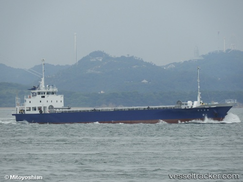
Amakusa
Current StatusWhere is the vessel?
Amakusa is currently in Near SAKAI, based on AIS data received less than 1h ago.
Latest AIS update:
Current position: 34.55425° N, 135.42090° E (Near SAKAI)
Average speed (last 7 days): Loading…
Average speed (last 30 days): Loading…
Vessel profile: Amakusa is a General Cargo Ship with dimensions 12m x 76m.
This page combines live AIS, route history, probable destination signals, nearby traffic, and port activity for practical vessel monitoring.
The current position of vessel Amakusa is 34.55425 lat / 135.42090 lng. Updated: 2026-04-19 21:34:43 UTCNearest reference points:
- Near SAKAI
- Near Nada-Ku, Hyogo
- Near Kobe
Details:
Live Vessel Amakusa Analytics (details, animations, etc.)
Recent AIS points (UTC):
2026-04-19 17:55:13 UTC · 34.56672, 135.44711 · SOG 0 kn · COG 288°2026-04-19 19:20:27 UTC · 34.56832, 135.38293 · SOG 12.2 kn · COG 173°
2026-04-19 19:34:29 UTC · 34.55451, 135.41682 · SOG 4 kn · COG 94°
2026-04-19 21:34:43 UTC · 34.55425, 135.42090 · SOG 0.1 kn · COG 95°